Saturday 17 November 2012

Reflection


On board - I'd do it all again in a flash!
See the group photo here
See a random selection of photos here


I've been lucky enough to make several trips to the UK and Europe, a stunning visit to Tunisia in North Africa, and last year I had a fantastic eight weeks in the US and Canada. Finally, I get to see a bit of my own country – and it has to be the most amazing thing I've ever done.

At the WA border


I loved everything about it – with the exception of the mosquitoes I do admit. I loved the remoteness; the views to the horizon that was many, many miles away; the beauty of water in dry, dry land; the red rocks and earth; the quaintness of remote shops, like general stores of 50+ years ago; did I say the remoteness?; the blue sea; the wide open sky; the light of the full moon and the brightness of so many stars when sleeping in the open, and so much more.

However, the final word after this amazing trip can go to someone who says it so much better than I can, Dorothea Mackellar .....


My Country

The love of field and coppice,
Of green and shaded lanes.
Of ordered woods and gardens
Is running in your veins,
Strong love of grey-blue distance
Brown streams and soft dim skies
I know but cannot share it,
My love is otherwise.

I love a sunburnt country,
A land of sweeping plains,
Of ragged mountain ranges,
Of droughts and flooding rains.
I love her far horizons,
I love her jewel-sea,
Her beauty and her terror -
The wide brown land for me!

A stark white ring-barked forest
All tragic to the moon,
The sapphire-misted mountains,
The hot gold hush of noon.
Green tangle of the brushes,
Where lithe lianas coil,
And orchids deck the tree-tops
And ferns the warm dark soil.

Core of my heart, my country!
Her pitiless blue sky,
When sick at heart, around us,
We see the cattle die -
But then the grey clouds gather,
And we can bless again
The drumming of an army,
The steady, soaking rain.

Core of my heart, my country!
Land of the Rainbow Gold,
For flood and fire and famine,
She pays us back threefold -
Over the thirsty paddocks,
Watch, after many days,
The filmy veil of greenness
That thickens as we gaze.

An opal-hearted country,
A wilful, lavish land -
All you who have not loved her,
You will not understand -
Though earth holds many splendours,
Wherever I may die
I know to what brown country
My homing thoughts will fly.
Jedda Rock, Katherine River Gorge

Whose problem??

I arrived home on the day that the Alice Springs Coroner released his findings on yet another Aboriginal death in police custody. The police involved were castigated on a number of accounts but all remain serving officers. Their shortcomings were not criminal offences apparently. But what of moral shortcomings? The law has nothing to say there.

And now, early in the week that I'm finally finishing writing about this trip, the front page of The Age was full of a report of the catastrophic effects of alcohol on the Aboriginal population around Fitzroy Crossing, ranging from deaths, including suicide, to half of all eight-year-olds suffering from Foetal Alcohol Spectrum Disorder.
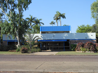
Jabiru Court House


A three week visit to the Kimberley region is, almost by definition, superficial. Yet when police stations, courts and legal aid offices were so prominent in small outback towns, alarm bells rang for me. It's not the “Aboriginal Problem” but the “Aboriginals' Problem” ... and that is us, we Europeans who have trampled on a 40,000+year old culture, expecting those people to conform to European culture and yardsticks within the space of a mere two centuries. Failure to comply is being punished, mercilessly in most cases. I don't know what the answer is but what we are currently doing is wrong, and it isn't working.

Flora and Fauna


Plants and animals are not even my vague area of general knowledge, let alone expertise.
If anyone knows what the unnamed flowers are, do let me know .... provided it's a common name. If it's botanical names for the plants – keep those to yourself! One couple on board were plant nuts. None had a common name: never called a flower a daisy when they could call it Asteraceae. If I ever hear another Latin name again it will be too soon!! Very keen on always doing the right thing they were, except they had a real blind spot when it came to picking flowers.
Kakadu
More flowery things here


These are a few photos that worked – or almost worked! There aren't many photos of wildlife simply because we didn't see that many. The country is so vast, and so poor in terms of growing feed, that the animals are few and far between and most of the ones we did see were from the moving bus. If you think some of these photos are bad you should see the ones that didn't make it here!
Blue-winged kookaburra
More living creatures here


One photo I didn't even try to get as it never would have worked – sparkly-eyed spiders. Walking to the loo one night my head torch picked up these tiny, tiny sparkles, like pale blue diamonds, so, so pretty. On looking closely, they were spiders' eyes. An opportunity awaits for a professional photographer.

Monday 12 November 2012

Last stop: Darwin


On leaving Kakadu, we travelled across to Litchfield National Park then, we headed to Darwin, arriving late afternoon. When I've been away before, no matter how much I loved it and how interesting, exciting, fun, a trip had been, by the end I always looked forward to home. Not this time. It was a great disappointment to see the tin and tile roofs of suburbia loom into view on the outskirts of Darwin.

That said, Darwin itself was not a disappointment at all. Originally I'd planned an extra day there but Qantas messed about with my flights. I saw enough to hope to get back there again and see it properly. Then again – reservation staff and I don't seem to hit it off in the Northern Territory. This time, the hotel couldn't find the booking for my second night there.

On the outskirts of Darwin we stopped at the Australian Aviation Heritage Centre which is more or less a giant hangar filled with old planes and associated memorabilia. My Aunty Hazel worked at Essendon Aerodrome during World War II, helping build aircraft, and she stayed on there until her retirement many years later, so I have that background interest. She started with ANA (Australian National Airways) which had morphed into Ansett by the time she stopped work. The largest exhibit is a B52 bomber. It was amusing to hear someone ask where it was when he walked into the hangar: it was so big he couldn't see it!
Only appropriate to put this here,
an exhibit at the Aviation Centre,
seeing as a similar plane has been the logo of this blog.


Then it was on into the city centre where our hotel was, overlooking the water. People, including me, pretty much flaked on arrival, taking time to luxuriate in a hot shower and put on fresh clothes before going down to drinks and our last dinner together.

Next morning it was an early start again. We had a morning tour of the city at the end of which some people were dropped off at the airport and various other places of accommodation for those staying on at cheaper hotel rates. I should have done that too for my extra night. I didn't realise how easy it was. However .....

The city tour fitted in more than I expected. Most of it was drive-by or drive-through, of course. But we got out near the Supreme Court, above the WWII oil storage tunnels and learned a bit of history, at East Point to admire the (smoky!) views, and spent a decent amount of time at the art gallery. The temporary exhibition at the gallery was the 2012 Aboriginal and Torres Strait Islander art awards. There was some fabulous work there – and as with any exhibition some that you'd struggle to be polite about. But one piece reduced me to tears; “I bin learn” by Deann Grant – 20 old-fashioned school slates with racist, patronising, negative, etc, etc things she had learned over the years. I voted for it in the People's Choice Award (doubt it will win) and suggested it be put on a postcard and delivered to every mail box in Australia (doubt they'll do that either). The extensive Cyclone Tracy exhibit was also impressive, particularly the room you went into to hear how it sounded at the time. There was, understandably, a warning on the door that some people might find it upsetting.

Back at the hotel, that left me with one afternoon before returning to Melbourne on a 7.00am flight the next day. And what a terrific afternoon it was! I was picked up at the hotel by Dianne, a library technician from Humpty Doo, and driven via the scenic route out to the hospital where health library colleague Gill was, luckily for me, at work that afternoon. We had afternoon tea and talked shop in a pretty impressive library set-up, even if they are short-staffed like many health libraries. Then Dianne drove me back to the hotel via the sunset market at Mindil Beach. That too was fun and I picked up some reasonably healthy(!) food for tea. Seeing the sun set at the sunset market was an appropriate almost-last sight after the most amazing three weeks I think I've ever spent.
Sunset at Mindil Beach
More Darwin photos here

Stations – oases in the desert

Welcome to Ellenbrae!


We stopped at a number of stations throughout the trip. These were oases in the desert where we lunched, had morning or afternoon tea, or camped. Not to mention, better toilets and the essential refuelling points – most important when there could be hundreds of km from one fuel pump to the next. The water available to make a green oasis was in stark contrast to the water available to the rest of the million acres or so of these stations.

Our very first stop was on a station – Tilmouth Well, a planned oasis on Napperby for the benefit of travellers. A fairly dusty oasis, nothing too picturesque about it, but it had the required facilities and was a good spot to learn about how the camping would work for the next three weeks.
Then we didn't stay on stations, as such, until the Gibb River Road.

Manning Gorge is on Mt. Barnett Station (as is the eponymously named Roadhouse!). Apart from the shower block, this was a bare campgroud, i.e. no irrigation to water a lawn (or grassed area!) that didn't occur naturally. The oasis was natural though – the swimming hole. We arrived there late and left early so apart from the swim had no time to further explore the gorge.

We had a toilet stop and truck refuel at Drysdale River Station on the way up to Mitchell Plateau then we stayed one night at the homestead campground on the way back. Some were delighted to have bar facilities but that didn't interest me. What I remember most is, unlike everywhere else that was so laid back, here at the camp shop they were sticklers for business hours. I rocked up 2 minutes after closing time and they wouldn't serve me, even though I told them I wanted to buy three handmade cards/pictures (suitable for framing, made by local Aboriginal artists) that would have been worth an extra three minutes on their part I'd have thought. But no.

Ellenbrae is owned by Big Business (the Grollos) but has the local, personal feel of a family run homestead. There's plenty of water for irrigation and it shows, with lush green lawns, beautiful gardens, and a vegie patch. This was the morning tea stop with the Devonshire tea!

Home Valley Station, HV8, is run by the Indigenous Land Corporation and is a training station for Aboriginal Australians across the Kimberley region. It was a great place for a lunch stop, on the Pentecost River (stay well clear, saltwater crocs!) and looking towards the Cockburn Ranges.

El Questro Wilderness Park is the station where rich folk stay. Not inappropriate that we stayed at Emma Gorge Resort, the cheaper of the two built accommodation areas at ELQ, because the tour itself wasn't cheap. The Homestead is much more expensive, apparently – we didn't get to see that! The camping area was certainly well watered and grassed. We had a morning tea stop at the camping area after our relax at Zebedee Thermal Springs, also located at El Questro.

The stations were all different but all equally appreciated. They provided variety and pleasant stopping spots along the way – and saved us from too many 'behind a bush' toilet stops!!  But I did love best our lunch and morning and afternoon tea stops that were in the middle of nowhere. The isolation was magical.
El Questro
More Station photos here

Sunday 11 November 2012

Two Climbs: One more gorge – Emma Gorge at El Questro Station – and Ubirr at Kakadu

As mentioned previously, the “walk” up to Emma Gorge waterfall was described as “medium level of fitness required”. I kept up reasonably well on the way up but coming back was a different story. I fell further and further behind. Tour director Les stayed with me the whole time. Whatever he was thinking, he didn't rush me at all, even stopping to point out different things to me – including poisonous seeds – as in kill you, not just make you sick, if you ate them. They were very pretty!

All the same, I had two aims, to get back before dark and to get back before they sent out the search party! I gather we were only about 20 minutes behind the next-but-last down, so they must have been a bit slow too, but it felt a much bigger time gap than that.

It was hard work, climbing on all fours in part, but because it was slow going, it wasn't the sort of “puff you out” difficult. It was the awkwardness and lack of flexibility on my part – which would make it hard for anyone who wasn't too nimble on their feet.

But soooo worth the effort! The swim was fun, the water having pockets of warm water in what was otherwise bracing, until you got used to it. And my two aims were met!! Plus, the added reward of a real shower in the ensuite bathroom in my 'tent'.
Easy part near the start of the walk.
Note the blue pathway indicator.
More Emma Gorge photos here.


*****
On the approach to Ubirr


Ubirr was a very different climb. First, there is the extensive rock art. The artwork was well sign-posted so you had a good idea of what you were looking at. Most fascinating of all was a painting of a Thylacine which I thought only existed in Tamania, because of its common name, the Tasmanian Tiger, and which finally became extinct in that state in the 1930s. What dingoes started, white man and his guns finished off.
About Thylacines


Thylacine painting
More rock art here


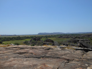
Then, after a bit of climbing along the art pathways, there's the climb to the top of Ubirr rock itself, giving fantastic 360 degree views.
I wasn't sure if I was going to be able to manage Ubirr. There were no warnings in the itinerary but the signs at the site were a bit off-putting: it was a particularly hot day and I was still feeling edgy after the sky-high blood pressure reading at Kununurra. However, I set off, thinking I could stop and go back if needs be. I'm glad the signs and my nerves didn't deter me. It wasn't that hard and the effort was more than amply rewarded.
Looking from the top of Ubirr Rock
across the monsoon forest
towards Arnhem land
More rock climb photos here

Rock Art - Leaving Mitchell Plateau

Every day I carried a light backpack with me – more of a fabric bag with straps really. In it I carried things I might need – and usually didn't. Twice, getting off the bus, I decided to travel light and leave it behind, both with dire consequences. Once was at a rock art site and my camera's SD card became full. The second was on the Yellow Waters Billabong cruise at Cooinda. At least on the latter occasion I had my phone with me and could take photos with that, after a fashion – the light was so bright it was all but impossible to see what I was actually snapping.

So it was that, coming back from Mitchell Plateau, near the King Edward River crossing, we turned off the road to this unmarked site and came to the most remarkable collection of Aboriginal rock art – only some of which I was able to photograph. Fortunately there was a second site nearby, by which time I'd replaced the SD card, but in deleting not so good pictures randomly at the first site, the pictures themselves became a bit of a muddle in terms of knowing what was taken where. But that was a minor hiccup.

Both sites have some protective fences but no signposts that they're there. Few people go there so there isn't a lot of chance of damage – although one member of our group had to be told “Don't touch!” - but no doubt looking to the future in protecting the sites from too many visitors. The art was amazing. It's also incredibly complex. As 21st century Europeans we see it as simple figures, but to the artists and the Aboriginal people looking at it, complex stories are being told. Too much for me to take it all in.
You can read a little more about this rock art site here 

At one point I could have taken photos but didn't. Again, some did in spite if being asked not to, as this was a sacred site. Aboriginal culture in this part of the world is to bury a body for a certain time and when, amongst other considerations, the bones are bare and parched, those bones are then moved to a permanent burial site. We saw some of those temporary burials, in rock niches, open to the elements, while we were there.
Not just any old rocks!


King Edward River (Munurru) Rock Art
More Photos here


Crossing the King Edward River, leaving the art behind

Tuesday 6 November 2012

Mitchell Plateau

Getting to the plateau
After a feast of gorges, it was off to the Mitchell Plateau and Mitchell Falls. Dispensing with the bad stuff – this was the one and only place where the toilets made me gag and, unfortunately, we were there for two nights. It shouldn't have been that way – they were long-drops and there was a resident ranger who should have kept them up to scratch. OK. Done with the bad.

The Kalumburu Road wasn't too bad at all – about as bad as I'd expected the Gibb River Road to be but wasn't. It was slow going and we bounced along, but it was OK. I was astonished at the huge number of Livistona palms growing in the area. These were the palms I'd been so anxious to see at Palm Valley. Granted, the Palm Valley specimens were more lush, but they were growing in and around the Finke River so got more water.

That night we were half expecting our guide for the next day to arrive and give us a preview talk, but he didn't show. Not a wasted evening though, sitting around one of our better camp-fires.
Lots of Livistona palms
More photos here


Hiking to the Falls
Another expectation bites the dust. Because a helicopter flight back after the walk “down to the falls” was included in the price of the tour, I assumed it was going to be pretty steep going down. Not so. Rough, certainly, but that made it slow going more than anything, although coming up on even the slight rise from “the bottom” would probably have tested me and one or two others I suspect.

We made lots of stops along the way as Brownie, our guide, explained all about aboriginal lore, plants, animals, rock art ... and we looked at the scenery! First stop was Little Mertens Falls, no indicator of what was to come but giving another great cross-country view. Next was our first major rock art stop. It's amazing stuff. Aboriginals are allowed to refresh the artwork, according to their needs. Remember, these are the equivalent of Western arts' stained glass, paintings, mosaics, murals, etc for passing on stories in a pre-literate age. Not all rock art has been refreshed, so much so that for some, the colour is there but nothing of the 'paint' that can be carbon dated.

Next it was scrambling behind a small waterfall (not exactly reminiscent of being behind Niagara!) then across boulders that were a foretaste of the climb to Emma Gorge. Rest stops, be it amongst the boulders or along the rocky path, always involved a search, usually unsuccessful!, for a comfortable spot to sit. (Needing to search for safe and/or secure footstep places goes without saying!) Shade was often at a premium too. It was hot!

Then we got to Mertens Falls, with a sizeable gorge, some beautiful pools, and, joy, a Mertens' Water Monitor, a gorgeous fellow (or female?) who eyed us off but seemed unconcerned at our presence. Water was flowing over and down into the gorge - just! - but it's impossible, really, to imagine what the falls must be like in the Wet. More rough and rocky 'paths' to negotiate, and we were there!      
Tiny wildflowers on the way to Mitchell Falls
More photos of the hike here


Mitchell Falls
First stop before the falls proper was a swim in the Mitchell Falls pool. This is where I finished up jumping in fully clothed after thinking I'd just paddle my feet. The memory of the fun and deliciousness of it hasn't dimmed.

After swimming we got our first view of the falls. Pressing on, walking across rock, it was very easy to see in the rock markings, indentations, etc, that it was very like rock-pools at the coast. Hard to believe it was under water millions of years ago. Finally we came to where we were looking directly across to the falls – 35 storeys high was the figure quoted to us. Amazing sight. Again, hard to imagine the falls in the wet. I was pleased to see the rainbow at the bottom of the falls. It's one that is referred to as a Rainbow Serpent in Aboriginal mythology.

There were some spectacular views from the helicopter – I was in the front seat again – as we flew twice around and over the falls. In this situation my shortcomings as a photographer become all too evident. But even bad photos that I have taken make the memories come alive.       
Mitchell Falls
More photos here
                                       
Mitchell Falls in the wet
Photo credit


The perfect end to the day was a swim in the swimming hole by our camp. It was the most enclosed swimming spot we were in with the 'things' in the water a bit harder to ignore ... bugs, little fish, slimy rocks .... but it was nevertheless probably the longest time I was in the water apart from the pool at Cable Beach resort. And we had a bird guarding our towels and sandals.

Swimming hole near Mitchell Plateau camp ground


"Guard Bird" at the swimming hole

Sunday 28 October 2012

Four gorges and a tunnel or two

Besides the lack of plumbing, the other big challenge for me was always going to happen when we started to walk, my being more in favour of 'exercise' that involves turning the pages of a book or twisting wool around knitting needles.

Two activities on the itinerary came with warnings: the entrance to Tunnel Creek (“quite challenging”) and the walk up to Emma Gorge waterfall (“medium level of fitness required”). In fact, my level of fitness, while it could and should be better for all sorts of reasons and occasions, was OK for this trip. People in my age bracket would be more likely to find difficulty with flexibility – or lack thereof! The rough terrain was the biggest problem. There were some pathways in Kakadu but in the Kimberley there were virtually none. The tramping of many feet caused earth to compact into a path if there was sufficient soil, but often there wasn't. Instead, what you had was indicators of best routes over stone, ranging from pebbles to boulders.

The steepest walk was quite short – up to the rim of the Wolfe Creek crater – and it did have a defined path, although rocky underfoot once you got to the climb.
Climb to the rim of Wolfe Creek Meteorite Crater
- steeper than this looks


Both Tunnel Creek and Emma Gorge presented you with boulders for which I found “all fours” better than two feet and a walking pole. I didn't get exhausted anywhere but I was amongst the slowest, in fact the very last down from Emma Gorge.

After negotiating the entrance to Tunnel Creek it was down into the water, up to the top of my thighs – the one day I wore shorts! Dark too, literally a tunnel through the Napier Range with light midway where part of the hill had fallen in – a long time ago, we weren't in (much?) danger ... although you never can tell – there were warnings! On the way out my head torch (a great invention!) picked up the eyes of a crocodile resting on a ledge at water's edge. We didn't bother each other!! And I was too busy watching my footing to worry about the bats overhead. Back in daylight at the far end, the air wasn't thick with butterflies but there were still a few late-season ones about. It was a beautiful spot to have a picnic but you'd need to plan it well. Then back out again, stumbling along tentatively in the watery dark, over the entrance rocks again, and out. Magic!
Outside Tunnel Creek
See Tunnel Creek photos here


We camped one night at Windjana Gorge, getting in too late to see the gorge that evening. We nevertheless walked there and through the tunnel but stopped at that point because we couldn't see too much by torchlight. Funny that! So much better seeing it very early next morning instead – beautiful. Flat, easy access too. The short tunnel hid the beauty from you as you approached so that there was a gasp of delight when the gorge appeared. You can walk some distance but we only loitered close to the access point so didn't have to work too much for that treat. The hardest part was walking in the sand of the river bed, trying without much success to imagine floods of water rushing through.
Windjana Gorge
See more photos here


Bell Gorge wasn't even on the itinerary. That was one of the fabulous things about this trip .... doing so much more than expected. Another easy walk to what was obviously and understandably a popular swimming spot.
Bell Gorge
More Bell Gorge photos here


Our group didn't swim at Bell Gorge because we were heading for a swim at Manning Gorge  later in the day, but in between we had a stop at Galvans Gorge (not exactly a difficult walk but you had to concentrate) where some, but not I, swam.

Swimmers at Galvans Gorge
See more of Galvans Gorge here


This is stunningly beautiful country!
Manning Gorge


Manning Gorge riverbed at sunset


Sunday 7 October 2012

Truckin' 2

There's swimming, flying, sailing and the towns .... and there's Terra Firma, where most time was spent. So much of that time was spent travelling, mostly on unmade roads. Yes, we bounced around a bit with the occasional jolt here and there. But really it was very comfortable. Never once did I think “Aren't we there yet?” or “Let me off!!” I even dozed a bit, sad to say as I missed the scenery.

People will say, “Oh, but the scenery doesn't change much.” In fact, it does. Slowly and subtly, but change it does. Wide, flat, open; hills, trees, scrub, palms; water crossings, with and without water; termite mounds, big and small; the very rare building of some sort; roadhouses, fences, no fences; passing traffic, every hour or so.

The first major trek was across the Tanami Desert. Next was the drive into Purnululu NP, just on 60km off the Great Northern Highway but it took 2½hrs to do it, such were the twists and turns.

The second major trek was the iconic Gibb River Road. I expected this to be really bad, but it wasn't, well not from the point of view of this passenger! Mind you, I wouldn't have wanted to drive it!! The wear and tear on the truck was enough to make you realise you'd have to be prepared to write off a vehicle if you drove a 4WD across. It wouldn't necessarily happen – although it did to a woman trying to hitch to anywhere from Mt Barnett Roadhouse! It would definitely take years off the life of a 4WD though and only a fool would attempt it in a regular car. That said, the road was in pretty good nick, reasonably graded. But you can see why you don't travel the Gibb in the wet. Seeing the height that water reaches by the debris caught high in tree branches – you'd need your floaties, and then some!!

The third, though shorter, major trek was on the rugged Kalumburu Road, off the Gibb, then off that again up to Mitchell Plateau on the most rugged stretch of all.

Pretty much all the rest was on sealed roads. The romantic factor took a steep dive! Anyone wanting to experience the romance of the Gibb needs to get on with it. It's sealed from the Great Northern Highway to Emma Gorge Resort and major roadworks are under way to seal from there to the El Questro Homestead turn-off. Once that's complete it's not hard to imagine that the rest will follow, not quickly perhaps, but the days of the unsealed road look to be numbered.

I've not read any words nor seen any photos anywhere that do this trip justice or give a real appreciation of the majesty of Kimberley country. But I'll try to give a little of the flavour with these photos.
Start of the Gibb River Road, near Derby,WA
More photos -
Gibb River Road - Part 1
Gibb River Road - Part 2
After the Gibb - Part 1
After the Gibb - Part 2

Monday 1 October 2012

Accommodation and the unmentionable

The proper accommodation, i.e. in a building with a proper bed and your own shower and toilet, was nicely spaced throughout the trip. Best of all, I loved sleeping under the stars. I coped with the shower blocks, was glad there weren't too many behind-a-bush toilet stops. But along with most others, I was always counting down to the plumbing of real civilisation. It varied from the luxury of Cable Beach Club, to the most expensive but nothing out of the ordinary hotel in Darwin, to a couple of better than average motels, to a permanent “tent” at Emma Gorge.
Wee small hours - full moon
at Drysdale River Station


"Tent" at Emma Gorge resort -
complete with en suite bathroom!


The stars are so shiny and numerous and the full moon was so bright. We miss these things in our cities filled with light pollution. I put up a tent when we were staying somewhere for two nights, as much as anything because it seemed odd to leave my belongings simply stacked in a pile when we went off for the day. It was the thought of it looking odd, security was unchanged. I finished up sleeping in the tent for three nights. One night there was a lot of dew and my sleeping bag got wet. It dried quickly the following day but I didn't want to be rolling up a wet bag after the night after that. Then we hit the big smoke of Kununurra. What a shock to the system! That camp-ground was very much high-density living after the isolation across the Gibb River Road. No room to put a tent up and have outside space for a stretcher.

I did have one bush shower – in a canvas cubicle with a hose poking in at the top. It was only put up once, for the experience I guess.

I spotted a couple with Outback Spirit backpacks arriving at the hotel in Darwin. I asked their owners what trip they were doing .... the reverse of what I'd just done. I said what a brilliant time they were in for then the man said to his wife, “I'll check in and you can talk about women's stuff.” Well, he and she meant toilets, didn't they? Were there many bush stops? A few. Were there really bushes at bush stops? A few, not always too bushy though. I was very pleased that in the gym programme I did before going away that squats featured and had to be practised often – it put me in good stead ;-)

The long drops – varied in design, pretty clean on the whole, didn't smell too bad, sometimes worse at a distance when 'the odour' drifted across to the camp-site on a breeze. Only one that made me gag and there was no reason for that – there was a resident ranger at Mitchell Falls so things should have been in tip-top order. The thunder-box over the hole in the ground when crossing the Tanami worked – although the hole could have been deeper. There was plenty of paper on board where that wasn't provided or had run out, and hand cleanser got used when there were no taps ... and in addition to a water wash when taps were available! For someone who always swore she'd never go anywhere where there wasn't a flush toilet, I did pretty damn well!!! 
If you see what I mean - photos here!

Sunday 30 September 2012

Civilisation along the way


After Alice, Halls Creek was the first town we came to. We stopped the night here, stocked up for our two nights at Purnululu, and stopped here for lunch on the way back from Purnululu to Fitzroy Crossing. So not the greatest of sightseeing spots.

There's an 'Old Halls Creek' which was abandoned in 1955 with the town moving to less hilly country when a new road was put through. The old cemetery remains and traces of the town, a few street signs, footings of buildings. The largest remainder is ruins of the old post office, made of termite mounds crushed and turned into mud bricks.
Fireplace at the remains of the old Post Office


A local legend is “Russian Jack”, famed for carrying/pushing a sick and injured prospector in his wheelbarrow from Derby to Halls Creek in the 1880's during a gold find. The injured prospector is a great-grandfather of a friend of mine!
"Russian Jack" monument 


And the local butcher lived up (down?) to his advertising boast when a stew made from his meat was the only meal our cook made that could be criticised.

Would you buy meat here?!


...........................................
For us, Fitzroy Crossing was merely a stopping place. Mind you, the camp site was about the best we stayed at with a terrific shower block – you come to appreciate such things! It was a full day's drive from Halls Creek to get there, then in the morning it was up and off to the Geikie Gorge cruise before heading straight on to Broome.

The river at Fitzroy Crossing - literally miles wide when it floods


...........................................
Broome is a booming place, houses going up all about.
I'd never seen the point in a resort until arriving at Cable Beach Club. Excellent indeed for completely chilling out, unwinding, relaxing. The only negative was the shortage of washing machines as we all brought out our dusty, dirty clothes from the previous week ... hardly a serious complaint. The grounds were beautiful and extensive - so much so that I kept getting lost between my studio apartment, the pool and the restaurant! The climate is such that the restaurant has no walls at all along what would be the wall looking out to sea. So easy to see the sunset and the camels coming back from sunset rides .... one of which I'd never intended to try. No reason for a camel to suffer me on its back! 

Because of the unexpected Cessna flight, I didn't get to see too much of Broome itself, the biggest “didn't see” being the lighthouse and dinosaur footprints at Gantheaume Point. We arrived back from the flight in time to catch the presentation at the Pearl Luggers museum about how pearling was done “in the olden days” - pretty horrific really. After that, I walked around the town centre and bought a couple of 'sun block' tops – cover-alls to wear instead of using lashings of sun block cream. Later, the iced coffee wasn't half bad either!

The Staircase to the Moon wasn't the perfection of the advertising brochures. You did get the idea of what it could be like but smoke in the air turned the moon red and lessened the reflections on the water. But the rising red ball was magnificent in itself and was accompanied, at our viewing point, by a 30 minute didgeridoo solo that was hauntingly beautiful. There was no disappointment at that turn of events.

Glimpses of Broome here. Including the best I could manage of the Staircase to the Moon. Aboriginal men wore pearl shells much as a Scotsman might wear a sporran!

.........................................
Derby was our morning tea stop (by the wharf) before starting up the Gibb River Road. The town, on King Sound which has Australia's highest tidal variations, up to 11m, is smaller than I expected but well kept, giving the impression of an active, prosperous community. New civic buildings added to that impression. I loved the median strip in the main street, planted with boab trees!

On the approach to town there is an historic boab, believed to be 1,500 years old, whose hollow trunk was used as a prison for Aboriginals. Nearby is a concrete water trough, built in the early 20th century, that could handle 500 head of cattle at a time fed by bore water. Initially it didn't run dry but that only lasted a couple of years so a windmill took over pumping in the water. Over-use of natural resources is obviously nothing new!

A bit of Derby here.

..........................................
Oh dear, Wyndham, also smaller than I'd expected. Was this ever a godforsaken place!! Or so it seemed. Perhaps appearances were deceptive ... there is a busy port there. And it's home to the 20m long “Big Croc” .... another “Big” Australian! At the entrance to the town is a collection of sculptures, an Aboriginal family and some native animals.

The Big Croc
Aboriginal family group


We had lunch at the lookout where you're supposed to be able to see five rivers flowing into the Cambridge Gulf. But it was hard to distinguish grey sea, grey mudflats, grey sky. Smoke again. Photos taken by friends Joan & Ken only a couple of weeks before tell a very different story.

My smoky Wyndham


Joan & Ken's non-smoky Wyndham


..........................................
Kununurra was a real mixed bag, the largest town we'd seen since Broome. The town was purpose built when construction on the Ord River Scheme commenced. It's got all the basics you would expect, including a hospital. I know that because I saw a doctor there! If I'd been at home I wouldn't have bothered but because it would be another week before the next chance to see a doctor, I went for a check because The Bug had given me some miserable days and more miserable nights with a hacking cough. No, “just a virus”, no need for antibiotics. But your blood pressure is way too high. Come back in the morning so we can check it again. Well, that wasn't going to happen but it put the fear of God in me, thinking I could blow a gasket at any minute. The first woman to catch The Bug, from the passenger who never should have joined us, put things in better perspective: Of course it's high, look what we've been through. And she was right. Nevertheless, on returning from the trip, I saw my local doctor, wore a 24hour BP monitor and then started medication. The diseases of Western affluence :-(

Apart from that, while remaining with the negatives ... this is the place where mosquitoes made a meal of me, even biting me through my clothes. I still suffer from those too, they're fading so slowly.

At Kununurra it was like rejoining civilisation, leaving the isolation of the Tanami, the Gibb River Road and Mitchell Plateau behind us .... most of us not being entirely happy to do that. Even the non-religious amongst us felt what could be termed a spirituality in that splendidly beautiful isolation.

The camp-ground was quite crowded, I had no choice but to sleep inside my tent. It was the place where smoke was the most oppressive, probably because it coincided with the worst of The Bug. Although crowded, the setting was lovely, on the edge of Lily Creek Lagoon, an offshoot of Lake Kununurra. I was sitting at lagoon's edge, calming down from the doctor's news, when bagpipes began. The piper played three tunes, one I recognised, one I didn't, the third was Amazing Grace. Sun was setting and it was beautiful. Our paths crossed when he finished playing and I was dashing back to the washing I'd left too long in the dryer. He was a young pilot with one of the local tourist airlines, keeping up his practice because he was a few thousand km from his regular pipe band! He said he practised by the lake quite often. What a bonus for bagpipe lovers like me!
After the Ord River cruise we visited the Durack Homestead, family home of one of the most famous names in the Kimberley. The house had been moved, stone by stone, from its original location because it would have been flooded by Lake Argyle. The solid walls, hallway running the length of the building, wide verandah all around and doors from all rooms opening onto the verandah would all have helped keep the place cool - relatively speaking. But it would have been jolly hot to live in more often than not.

We also made a quick detour to Ivanhoe Crossing, not that it's used much these days. With the development of the Ord River scheme water now flows across it so swiftly as to make it mostly unsafe.

I have to put in a plug for Artlandish, an Aboriginal art gallery. I was planning to buy some brightly painted clapsticks for the little English boys but the gallery attendant said No, they're too young for clapsticks ... well, Rufus yes, but I'd have thought Felix would be old enough to enjoy them. Instead, she suggested I buy a book, and a very nice book it is, but at one third of what I was prepared to spend. You have to praise someone who will take a lesser sale so the buyer gets the right thing. It wasn't as though she was going to see me again, she knew I was passing through. I was very impressed.
Lorikeets by Lily Creek Lagoon
More Kununurra photos here


...........................................
From Kununurra it was a long day's drive, 512km, across the Western Australia / Northern Territory border to Katherine. This is another major town, a stopover on the Stuart Highway, bigger than Kununurra ... first traffic lights seen since Alice! We had little more than an hour in the town before checking into our motel. A real shower and a comfortable bed!

I bought a necklace at a tucked away Aboriginal gallery and popped into the local library. I did think it a pity that the library was on the first floor of the building, missing out on a bit of passing trade, so to speak. But on speaking to the library staff I discovered the library had been on the ground floor but was moved upstairs after being flooded out a few years ago. I'm afraid I can't comprehend that. The river is in a deep ravine about 500m, at least, away. But it did happen.

 I got to ride shotgun for 1½ hours of this long drive. It gave me a different perspective on the passing landscape and I learned more of the life of a truckie from Brendan. Les was watching a film, sitting in my seat in the back :-)

Riding shotgun


Riding shotgun - the camera at the windscreen
showed the road ahead on a screen in the passenger pod
No longer seen on the streets of Melbourne -
a public telephone
Katherine Public Library - upstairs!
Traffic lights - Main Street (Stuart Hwy)


Old bridge on the outskirts of Katherine.
Water rose to the top of the bridge in floods a few years ago.


...........................................
Our second last town, township really, was Jabiru. A huge camp-ground booked out for the weekend, mostly for an Aboriginal sports carnival. The kids were well behaved, a couple of their minders could have learned a thing or two from them! The township is small but contains the basics. The permanent homes had lush green lawns. It's ironic that in the middle of the desert there is enough water for sprinklers that we can't use at home. The most notable building is a Holiday Inn, built in the shape of a crocodile. It's so big, and amongst plenty of greenery, that it's a bit hard to see, but you can pick out individual features.

The other main building, a little away from the township, is the Bowali Visitor Centre, a very well set-up introduction to Kakadu. It even includes a small but pleasant library.

The one jarring thing about Jabiru, Kakadu NP in general, was the roads .... so good that you might have been in the midst of well-funded suburbia. It was a bit off-putting after all the off-road driving we had done.

Jabiru - putting up my tent for the third and last time


Our last camp


Eye - Crocodile Hotel


Library - Bowali Visitor Centre


Seasons calendar


The seasons explained


Dugout canoe - Bowali Visitor Centre


Table set for our last camp dinner


.......................................................
Last Stop was Darwin but I'll leave that until the end.